Smoke Without Fire: How NASA Satellite Data Became Viral Misinformation During Iran Tensions
As thermal anomalies circulated online as alleged evidence of strikes on US warships, the reality of gas-flare emissions from Omani oil infrastructure exposed how easily satellite data can be weaponised for viral misdirection.
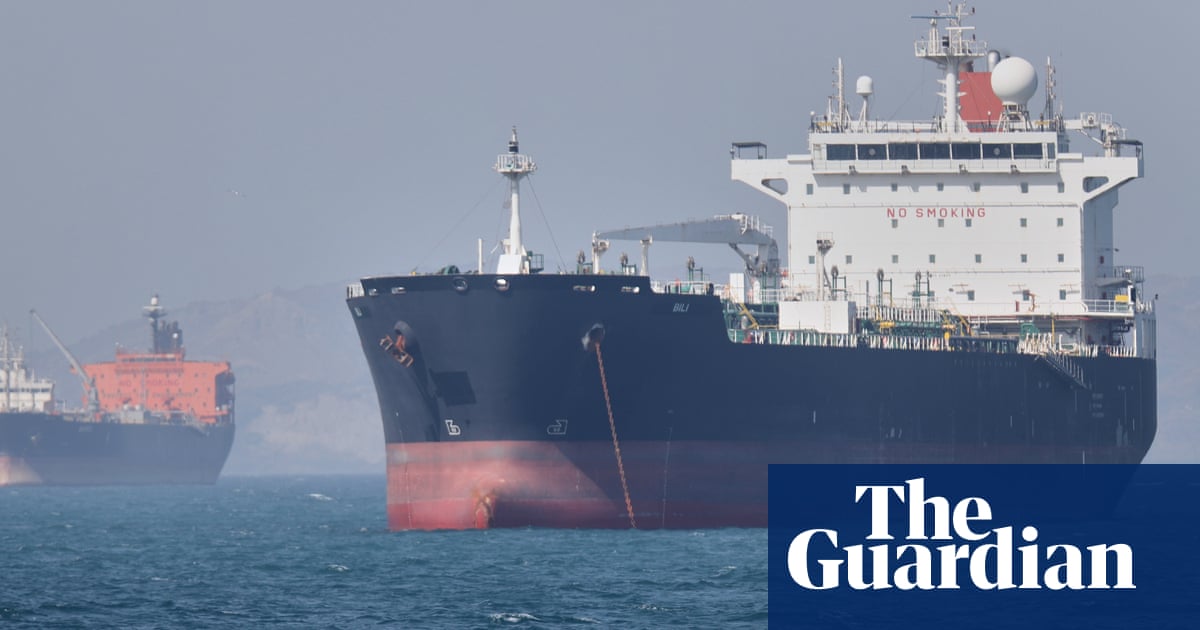
On the evening of 8 May 2026, as social media platforms filled with claims of Iranian ballistic missile salvos targeting US naval assets in the Gulf, a second wave of visual misinformation took hold. This time the evidence — or what passed for it — came not from shaky video footage or unverified Telegram channels but from the publicly accessible archives of NASA's Fire Information for Resource Management System, a satellite-based monitoring tool designed to track thermal anomalies across the globe. Screenshots of orange-red hotspots radiating from the Musandam Peninsula and the waters north of Khasab circulated with confident captions: proof, the posts insisted, that strikes had occurred.
The attribution was wrong. As OSINT researchers and regional analysts were quick to note, the thermal signatures in question corresponded precisely to the operational footprint of Oman's offshore gas and oil extraction infrastructure. Gas flares — the controlled burning of excess associated gas during petroleum production — register as nearly identical thermal signatures to combustion events in the FIRMS dataset. The platforms responsible sit in Omani territorial waters north of Khasab, a location that places them geographically adjacent to the Hormuz corridor where naval activity was simultaneously being reported. Proximity, in this instance, became indistinguishable from evidence for audiences primed to interpret every thermal blip as confirmation of their preferred narrative.
This episode illustrates a recurring pattern in the information ecosystem surrounding military crises: the hijacking of scientific monitoring tools by actors seeking to lend false legitimacy to unverified claims. FIRMS, operated jointly by NASA's Land Remote Sensing Political Division and the University of Maryland, is an extraordinarily useful instrument. It aggregates thermal data from the MODIS and VIIRS satellite sensors and makes it freely available to researchers, humanitarian organisations, and journalists tracking everything from wildfire spread to agricultural burning patterns. Its openness is a strength — and, as events on 8 May demonstrated, an exploitable vulnerability.
The question of what actually struck or failed to strike US naval assets in the Gulf on 8 May 2026 remains, at the time of publication, unresolved in the public record. Iranian military spokespeople issued statements asserting that US warships had been hit by projectiles. Western defence officials and US Central Command have not confirmed those claims. The Iranian assertions were circulated widely; the Western silence was treated, by some commentators, as implicit confirmation. Neither position is supported by verifiable evidence at this stage. What is documented is the proliferation of fabricated visual evidence in the gap between event and official confirmation — and the specific role that misinterpreted satellite data played in that proliferation.
The structural dynamic at work here is not new, but its mechanics deserve examination. Scientific datasets are coded for precision — they distinguish between confidence levels, differentiate between agricultural residue burning and open fires, tag approximate coordinates rather than precise ones. None of this context travels when a screenshot is extracted and re-circulated stripped of metadata. The NASA platform's own disclaimers note explicitly that FIRMS fire detections "should not be used without proper interpretation." That caveat is routinely stripped away in the social media sharing chain. What remains is a thermal signature shorn of its scientific provenance, reframed as military intelligence.
The practical consequences of this particular misinformation episode appear, for now, to be contained to the information environment rather than the policy one. Markets did not register unusual movements attributable to the FIRMS claim specifically. The Gulf shipping lanes that energy markets watch most closely remained open. US naval posture in the region, as tracked by open-source monitoring groups, did not visibly shift as a direct result of the thermal-map circulation. This is consistent with a pattern visible across recent crises: the rapid production and distribution of fake evidence tends to accelerate the information cycle without necessarily altering decision-maker behaviour, provided credible sources provide alternative framing quickly enough.
That said, the episode is not trivial. Each cycle of debunked misinformation that circulates widely before correction erodes the baseline reliability of publicly available evidence more broadly. When FIRMS data is repeatedly misrepresented as strike evidence, the legitimate scientific uses of that data become collateral damage. Journalists, researchers, and policy analysts who rely on thermal satellite monitoring for environmental or humanitarian purposes will find their evidentiary vocabulary contaminated by association with debunked military claims. The platform's credibility becomes a casualty of the information war, regardless of whether the war itself is real.
The immediate lesson for audiences encountering thermal-map evidence during a live crisis is methodological rather than political: FIRMS signatures require interpretation before attribution. The dataset does not identify causes; it identifies heat sources above a specified threshold. Industrial flares, gas wells, power plant cooling outflows, and actual fires all register. Without cross-referencing against known infrastructure locations, vessel-tracking data, and official confirmation, a thermal blip is merely a thermal blip. The rest is inference — and inference, without grounding, is the raw material of misinformation.
The Iranian military's claims regarding US naval vessels await independent corroboration. The Omani gas flares north of Khasab do not.
—
Desk note: Western wire services led with the Iranian military claims as unverified reports, consistent with standard sourcing protocols. Monexus flagged the FIRMS reinterpretation as the primary visual evidence circulating in parallel, prioritising the satellite-data misinterpretation angle over the unconfirmed strike narrative itself. The Telegram thread from Middle East Spectator provided the corrective on both claims — the gas flare explanation and the absence of corroboration for the warship hit — which became the structural spine of this piece.
Wire provenance
This editorial synthesis draws on the following public wire/social posts:
- https://t.me/Middle_East_Spectator/2475
- https://t.me/Middle_East_Spectator/2474